OCEANS Technical Day 2025
The flagship event of CADDEN is making its return, participate in the OCEANS Technical Day 2025.
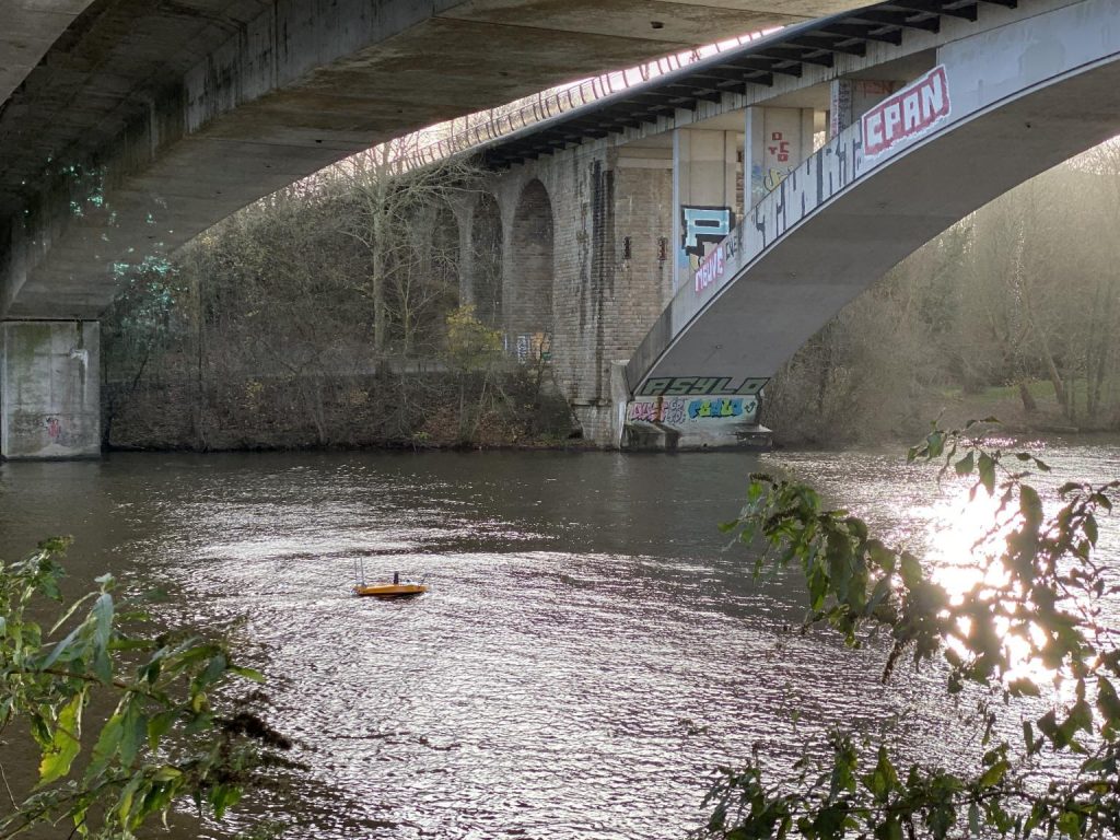
Our drones are manufactured for the purpose of conducting bathymetric surveys in inland waters, dams, quarries or mines. To carry out this mission, our teams use a specific equipment system for bathymetry.
In the photo above, our engineers equipped this “unmanned surface vehicles” (also called “USV”) of the R2Sonic Sonic 2020 multi-beam sounder for bathymetric data collection. This sounder is accompanied by SBG’s Ekinox inertial navigation system and Valeport’s MiniSVS sensor, which is used to capture the speed of sound in water. This state-of-the-art equipment is used for accurate and real-time bathymetry.
In addition to carrying out bathymetric surveys, our drones combine many features, including the ability to program a navigation circuit that they will carry out autonomously and automatically, during a full day of work.
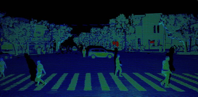
Lidar technology adds a topographic view to the features offered by the drones. The lidar is a laser remote sensing technology. The principle is based on the remote measurement through a beam of light sent to an object and then sent back to its transmitter. It’s the same principle as sonar but using lasers instead of a sound wave.


This technology performs many functions related to object or obstacle detection as can be seen on some autonomous cars equipped with lidar. In our case, it makes it possible to carry out complete topographies around drones during bathymetric surveys.
We are currently working with the VLP-16 from Velodyne, whose laser range is estimated at 200m.
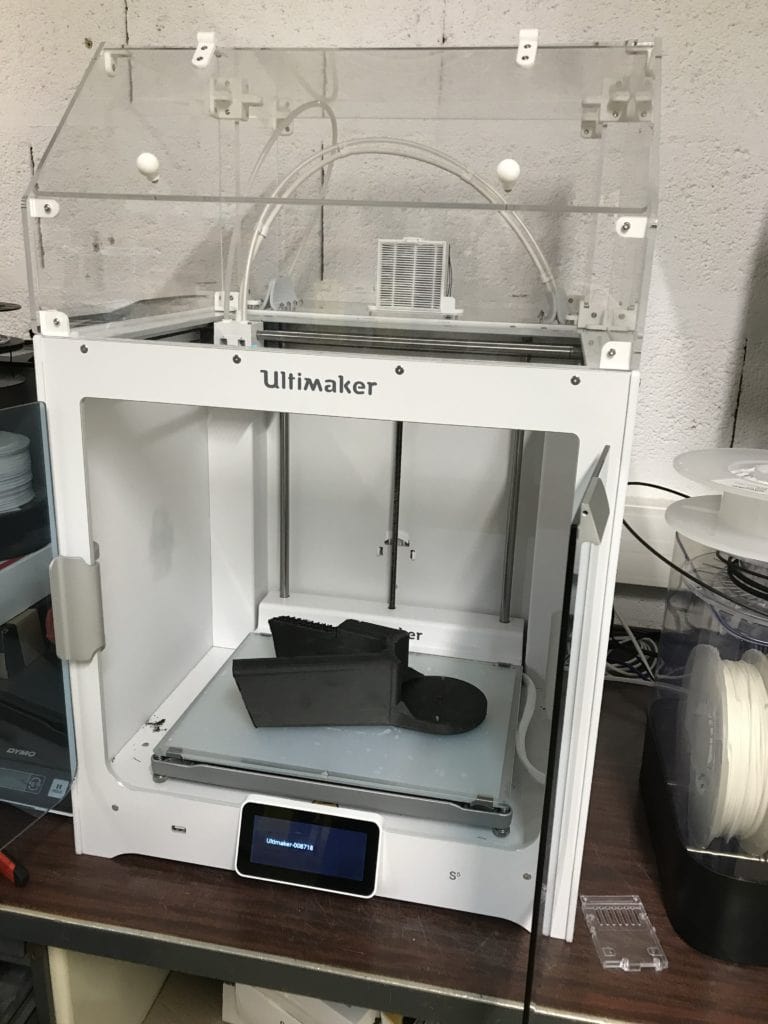
Our engineers have created a tailor-made base so that drones can host the lidar on board. The base was designed and manufactured in-house, thanks to our 3D printer. The material used is composed largely of carbon fiber, which makes the base very resistant.
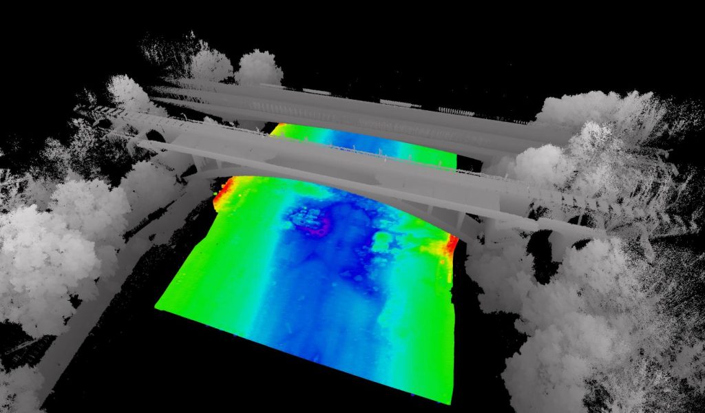
The lidar is placed at the front of the drone to better distribute the weight. The latter is positioned vertically to optimize the laser angle to obtain the best possible 3D image. The scans are performed on each side of the drone but also above it, creating a complete topography in real time.
Thanks to this integration of the lidar, our drones are able to perform a complete imaging of an environment, whether underwater or in the air, autonomously and, once again: in real time.
For example, during a bathymetric survey of a harbour, the lidar will allow to make a 3D image of the bank above the water, while the sounder takes care of the submerged part. This avoids the operator having to wait for the tidal change to cover the bank.
In short, it is a safety gain because the drone is at the heart of the action and allows the operator to manage and program the mission remotely. But it is also a productivity gain because it incorporates several mapping features into a single solution that can be managed by a single operator.


The flagship event of CADDEN is making its return, participate in the OCEANS Technical Day 2025.

The GNSS raw data management increases the accuracy of bathymetric missions with BALI.

CADDEN is proud to announce its new status as an authorized French partner of Hesai, world leader in Lidar.

Mentions légales – Politique de données personnelles – ©CADDEN
Vos données sont collectées et traitées pour vous envoyer notre newsletter et améliorer l’expérience utilisateur du site web. Dans ce cadre, le responsable du traitement est CADDEN. Vous disposez d’un droit d’accès, de rectification, et de suppression de vos données, ainsi que d’un droit de limitation, de portabilité ou d’opposition. Pour exercer ces droits, vous pouvez nous contacter via le formulaire de contact. Pour plus d’informations sur la façon dont nous traitons vos données personnelles, vous pouvez consulter notre Politique de confidentialité.