USV200 provides accurate data for hydraulic engineering missions
Published on
29 June 2023
The mission & the problem
A need for accurate data for hydraulic engineering operations
WSB AG is a Swiss-based subsidiary of the Eberhard Group, mainly involved in hydraulic engineering operations. This company is part of the Eberhard Group who is commissioned to carry out a wide range of projects in the fields of public works, construction, earthworks, hydraulic engineering, rehabilitation, and logistics.
Both upstream and during the construction phase, WSB AG teams need to know precise data on lake and river bottoms. The aim is to have accurate records for documentation and customer invoicing, so as to avoid any discussion of quantities and progress. Until now, the data obtained from various engineering companies had been imprecise. WSB AG was not satisfied with the accuracy and reliability of the data.
The solution
The USV with multibeam echosounder market was small, so the Swiss company quickly learned of the existence of the USV200. It was the only USV to be equipped with an oceanographic multiparameter probe, as Roland Weidmann, Geomatics & BIM Team Leader at WSB AG, explains:
“We use it at least once a month to document the progress of work or to check the height of embankments or excavations.”
Its ideal size is very useful for surveys in shallow water, and it’s also very easy to maneuver between the WSB AG’s pontoons. Now they are able to document and record the work carried out with the USV200 at any time.
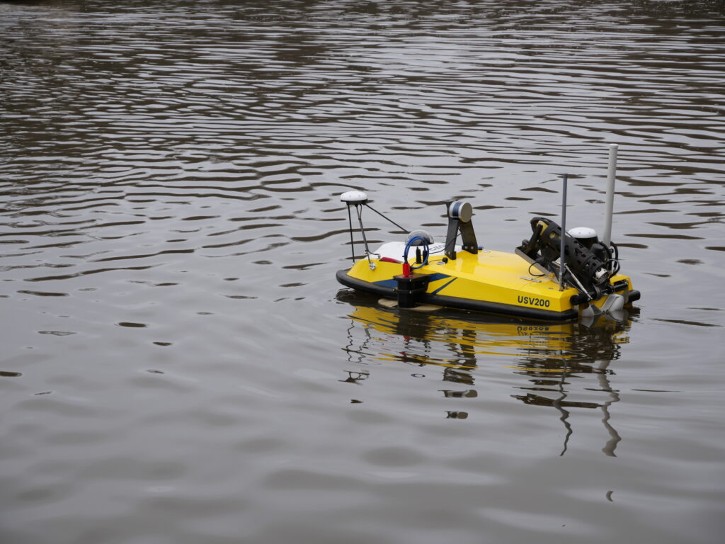
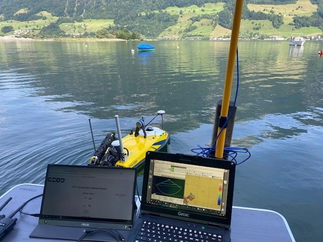
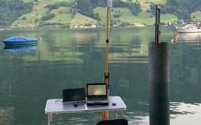
USV200’s set up
USV200 equiped with a bathymetric echosounder
The USV200 is configured with an R2Sonic multibeam echosounder, a Velodyne Lidar, an oceanographic winch with an AML-3 oceanographic multiparameter probe, a marine camera and a QPS license for bathymetry software.
For the time being, they mainly use the bathymetric sounder coupled to the oceanographic winch ; “we use the winch exclusively to create echo sound profiles so that we can obtain reproductible data”, says Roland Weidmann.
Analysis of the Rhine River and a harbour basin on Lake Zurich
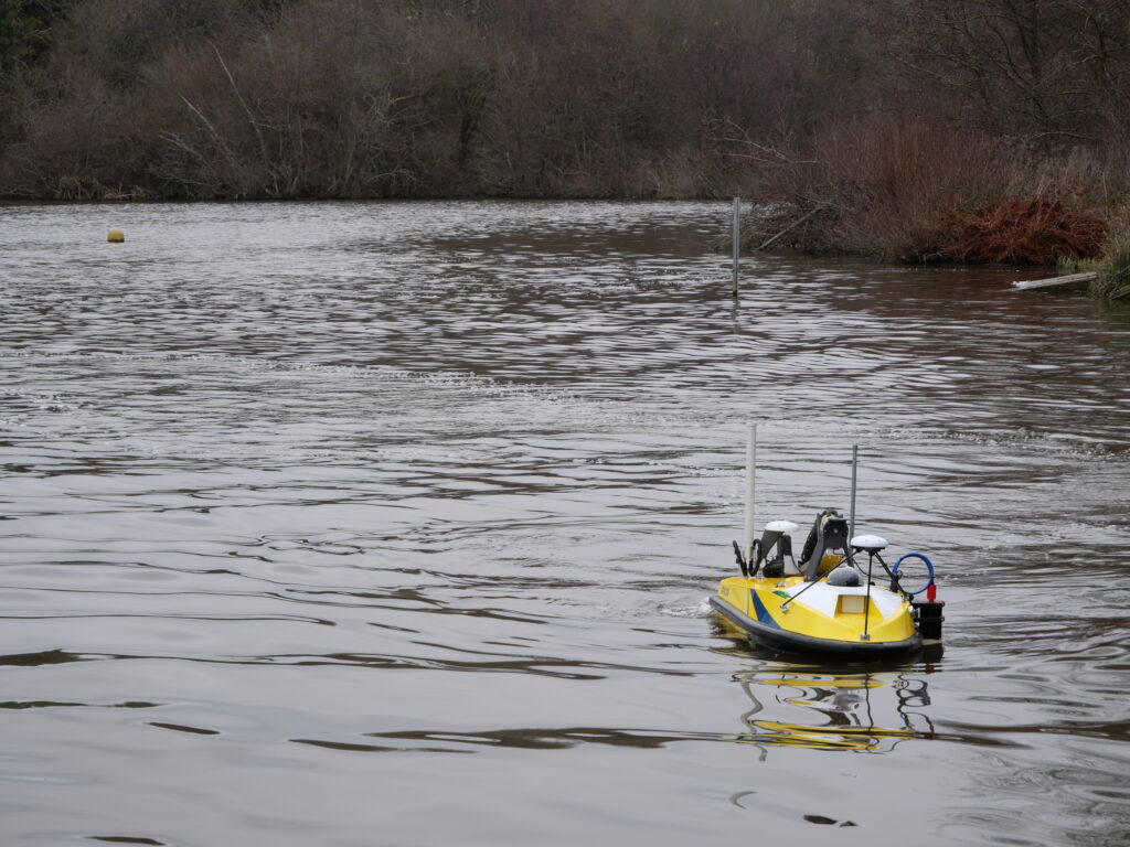
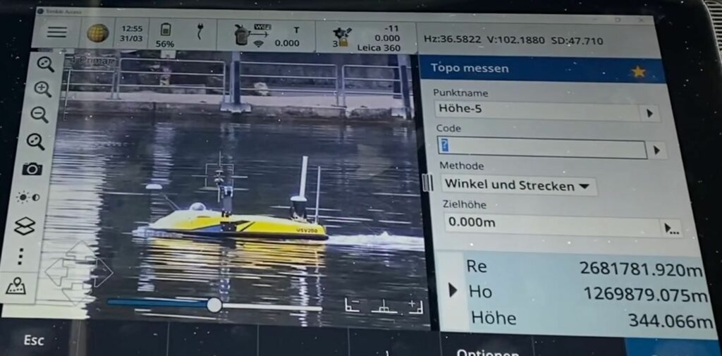
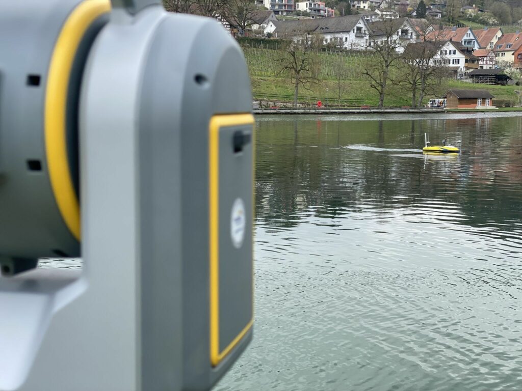
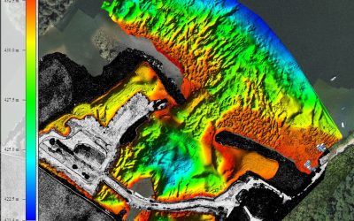
On one of its first outing, the team was positively surprised by the USV200 for its “astonishing efficiency”, according to Mr Weidmann and his team. Positioned with GNSS or a total laser station, the USV perfectly measured the bottom of the river (Rhine) or lake (Zurich).
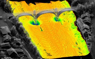
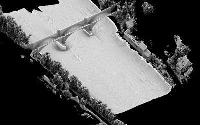
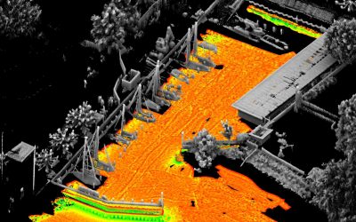
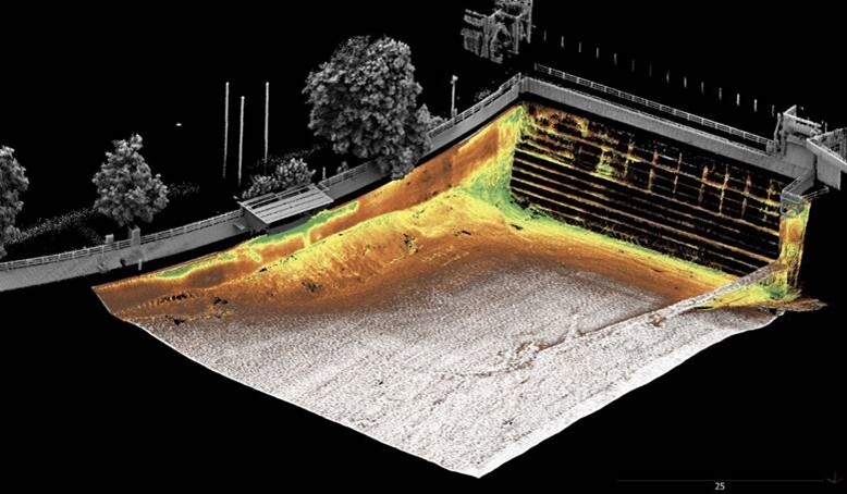
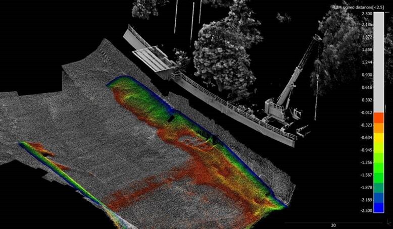
Thanks to the Lidar system integrated directly on the USV200, data from the land environment (riverbanks, bridges, etc.) can be coupled with bathymetry data to create complete maps of the river and port basin. This makes it much easier to understand all the data when viewing.
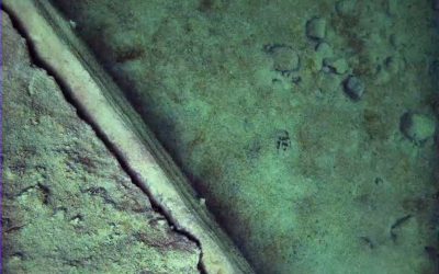
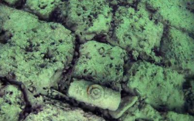
As the team was already on site, they took the opportunity to visually examine the bottom of the Rhine River with the underwater camera.
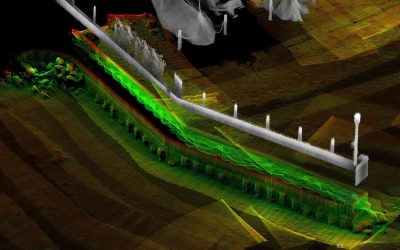
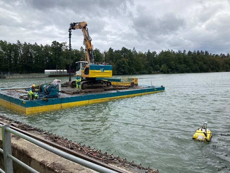
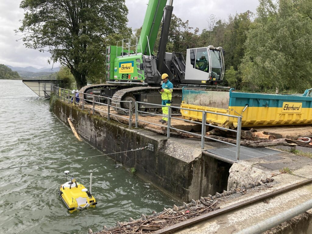
The sediment removal operation in the Aare River was monitored at the two power stations in the towns of Rupperswil and Wildegg-Brugg. The USV200 drone was used to take detailed photos of the sediment deposits before and during the work. The measurements obtained provide precise information on the location and quantities of sediment.
In the River Aare, water depths range from 6 to 15 m. Thanks to the rapid deployment of the USV and the multibeam echosounder, the recordings could be made in a very short time. As a result, the dredging work was not interrupted unnecessarily, and the operator of the construction machine was able to see the results of his work directly.
Quickly, in detail and live, it was possible to determine on site where there was still ablation to be done. This information provided the wsb AG team with the certainty and safety they needed to carry out rapid work above and in the water.
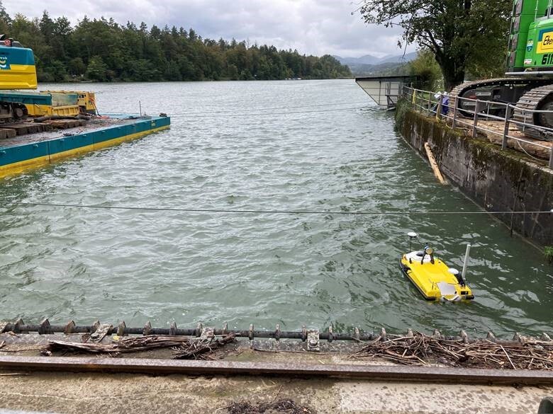
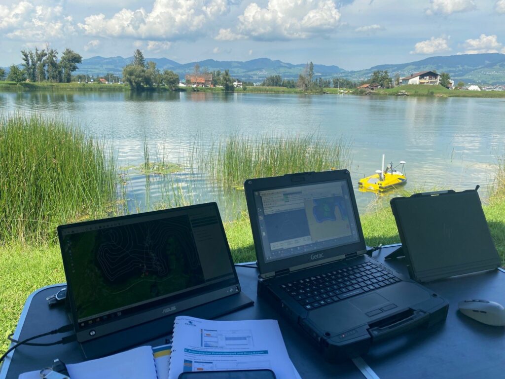
WSB AG’s teams took the USV200 to the south shore of the Alpnachersee in the Swiss canton of Obwalden to survey the lake bottom, even in areas where there was hardly any water under the keel thanks to its shallow draft.
During two days, the USV200 covered a distance of some 3900 m from the shore, and surveyed a surface area of 121,000 m² in detail using the multibeam echosounder.
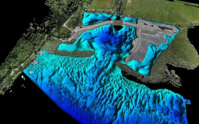
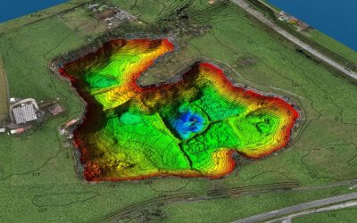
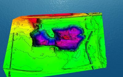
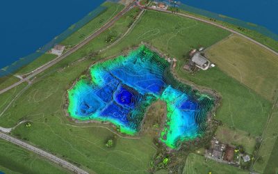
WSB AG had the opportunity to map the lake bed in a former gravel pit with the USV200. Thanks to the multi-beam echosounder, the details are clearly visible, and even the smallest irregularities in the lake bed are revealed.
The data obtained during the recording of the terrestrial terrain by means of an UAV (unmanned aerial vehicle) were coupled with those obtained from bathymetry to obtain a complete DTM (digital terrain models) for the following stages.
« The USV200 via Cadden convinced us because we were able to experience it in action at Cadden. We are very satisfied with Cadden, the support has worked flawlessly so far», says Mr. Weidmann.
Did you like this article ? Share it with your colleagues or friends
En poursuivant votre navigation, sans changer les paramètres de votre navigateur, vous acceptez l'utilisation de cookies pour garantir une bonne expérience sur notre site web.