Increase the accuracy of your bathymetric surveys with BALI’s GNSS raw data management

Data accuracy is an essential criterion for successful bathymetry missions, particularly in complex environments.
Compact and easy to deploy, the BALI pole bathymetry system has quickly established itself as the reference tool for hydrographic surveys in inland waters or confined environments.

BALI : a complete bathymetric system

Combining a single-beam bathymetric echosounder with a GNSS RTK receiver, BALI is a complete and easy-to-use pole-mounted system, entirely designed by CADDEN’s R&D and Technical team. The versatile GNSS antenna can be used on two types of vessels:
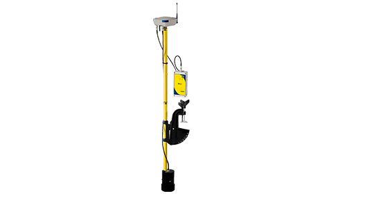
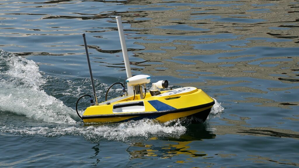
As part of a continuous improvement process, CADDEN’s research and development department regularly updates the BALI system. These developments aim to enhance its performance, optimize the user experience, and integrate the latest technological advances. With a dedicated team of engineers, CADDEN anticipates market needs to offer a system that is ever more reliable, precise, and adapted to field use.
Focus on the new feature

After winning over dozens of users worldwide, the BALI system has recently been upgraded to its data acquisition software. The GEOD range now includes GNSS raw data management. This option reinforces the complementarity between field mobility and precision requirements. It opens the way to more advanced post-mission processing, for even more accurate results, while maintaining the ease of use that is the strength of BALI.

1. Export GNSS raw data directly from the BALI interface

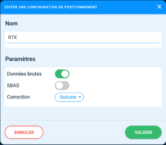
Before starting the mission, the operator creates a project in the BALI integrated web server for the hydrographic survey they are about to conduct. In this current project, they configure their positioning mode by checking the “raw data” box to record GNSS raw data. This operation will create recording files.
gnss-raw-data-bali-cadden

2. Advanced processing via one of the data with GNSS post-processing software

Once the raw data is extracted from the software integrated into BALI, it is directly integrated into dedicated GNSS post-processing software such as SPSO (Spectra Precision Survey Office), Spectra Geospatial‘s GNSS post-processing software, or Qinertia, SBG Systems‘ PPK software. The French inertial navigation sensor supplier also designs its own post-processing software for multiple applications (hydrographic surveys, mobile mapping, aerial photogrammetry, etc.).
bali-mission-qinertia

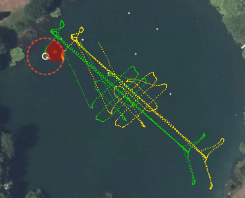
Above is an example of a survey carried out in a lake by our team using the BALI antenna integrated directly onto the USV100 marine drone. The yellow line is the natural trajectory and the green line is the RTK trajectory corrected using the PPK Qinertia software.

3. Reimport into BALI with corrected data

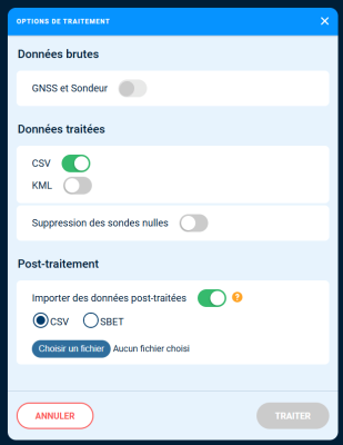
Once the data has been corrected using the PPK software, it is then fed directly back into BALI’s acquisition software, in CSV or SBET format.

This process ensures reliable, refined results that are ready for use in business tools.
BALI-import-gnss-raw-data-ppk

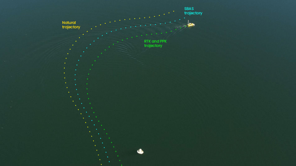
Below is an example of trajectories in natural (yellow), SBAS (blue) and RTK/PPK (blue) for a hydrographic survey carried out with the BALI antenna integrated on a USV100 marine drone.
The advantages

This development represents a real time saver and provides users with greater security in their data post-processing work.

  • Increased survey accuracy, even in complex GNSS areas (bridges, banks, structures, etc.)
  • Advanced trajectory quality control
  • Control of the entire data cycle
  • Interoperability with a recognized professional tool (PPK Qinertia software from SBG Systems)
  • Data exploitation on other platforms if necessary

Schedule your demo

Did you like this article ?
Share it with your colleagues or friends

Read next