Shom equips itself with light hydrographic systems for its overseas missions
Published on
22 November 2021
The mission & the problem
The Marine Hydrographic and Oceanographic Service (Shom) wanted to equip its boats with a rapid survey kit to carry out bathymetric reconnaissance surveys on partially surveyed areas, especially overseas (Nouméa, Papeete, etc.).
Shom's need
The Shom expresses the need to acquire several data acquisition systems for recgnition to support in situ decision-making. These systems are intended to be operated by non-hydrographer personnel (mainly deck personnel on boats), without prior training, from inflatable boats.
Several criteria were required
Easy to use (hand grip, daily use and maintenance);
Robust equipment (use from non-dedicated boats, open, with little protection to the saline environment);
Quick installation and implementation (lightweight and compact system, ergonomics adapted to the context of use);
Resistance to extreme conditions (operating outside temperature between -5°C and +45°C, storage temperature between -20°C and +50°C, shock and vibration resistance, salt fog resistance).
The solution
A light hydrographic system
In 2020, through a public procurement, the Shom chose Cadden to supply these lightweight hydrographic systems. The equipment proposed by Cadden is a version of the autonomous bathymetry system BALI adapted to the constraints of the Shom.
The BALI Hydrographic System is a bathymetric measurement system recognized for its ease of use and implementation of bathymetric reconnaissance surveys. The BALI Lightweight Bathymetry Kit is waterproof and robust, meeting the extreme conditions required by the Shom.
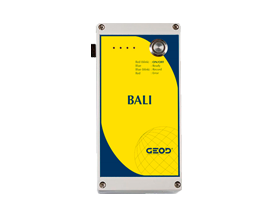
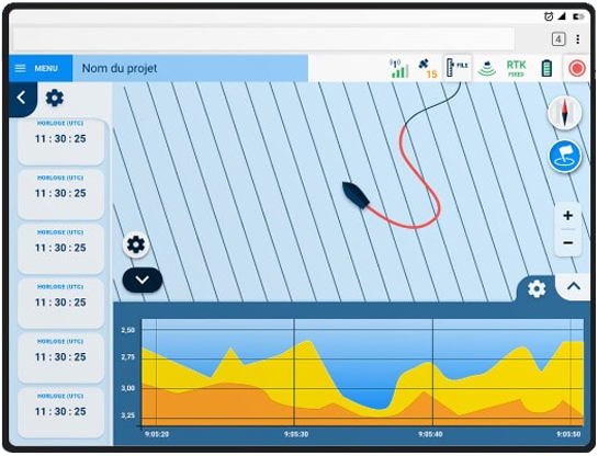
Thanks to the integrated and intuitive web server, the acquisition is simple and ergonomic with optimized data processing. Energy-independent, it incorporates a power box including a NiMH battery with 10 hours of battery life.
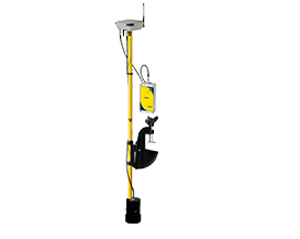
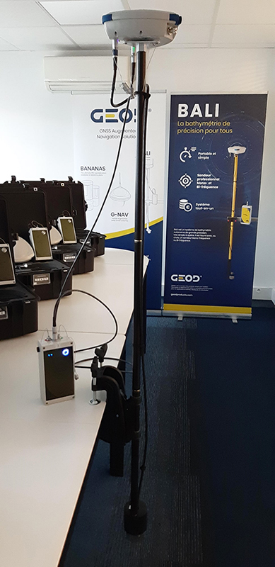
BALI: a light and complete hydrographic system for accuracy bathymetry
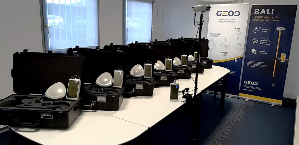
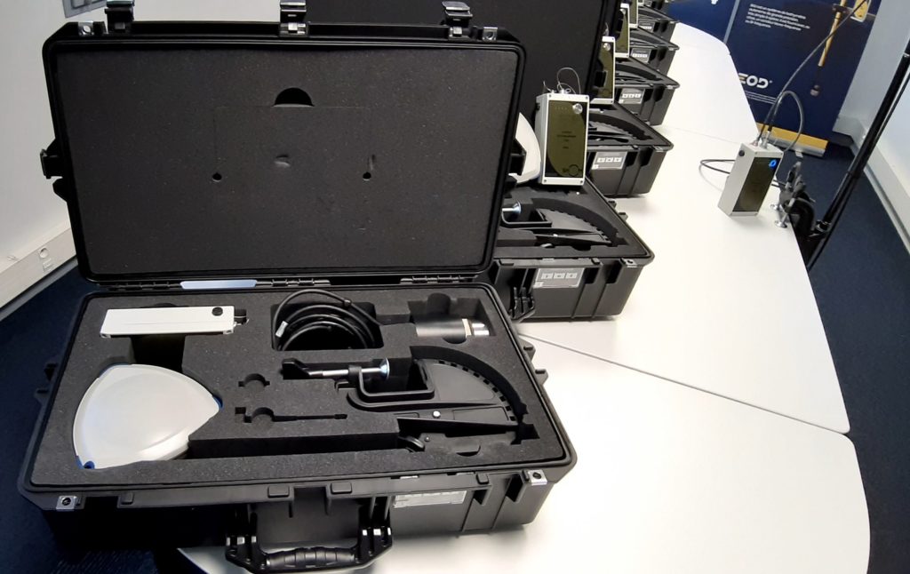
Accompanied by a carrying case and a PC with its carrying bag, the BALI bathymetry kit consists of several elements:
A GNSS antenna & Wifi server equipped with shock absorbers at each corner and waterproof connectors;
A pole composed of 3 masts, where the GNSS antenna and the sounder are mounted;
A robust power box;
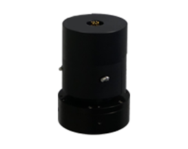
A single beam sounder, single frequency 200 kHz;
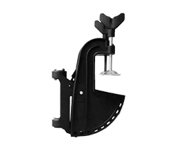
A pole attachment system that can be adapted to the rear panels of Zodiac® type boats.
Transport case
Integrated web server
Shom's opinion
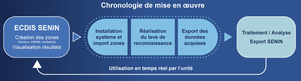
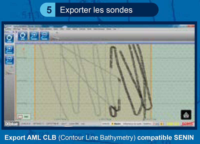
BALI meets the expectations of the Shom since users are satisfied with the lightweight hydrographic system provided; both by the simplicity of the acquisition, managed as a touch screen application, that in the optimization of the processing where interoperability with the SENIN* system, equipping the carriers of the National Navy, is a real asset.
*SENIN is a navigation aid system that uses digital mapping to enhance navigation safety. AML is referred to as “Additional Military Layer” in the case of overlapping layers of complementary information (e.g., meteorology, or others from embedded operational information systems).
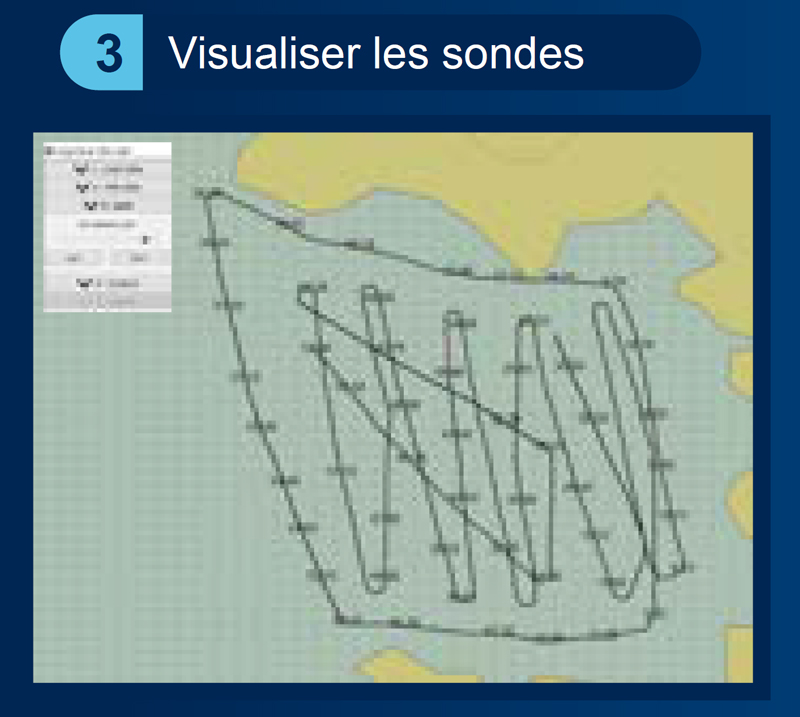
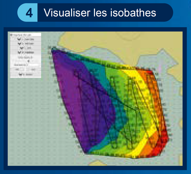
Optimized processing
Automatic management of the import and the geodetic system;
Visualization of positions and associated probes;
Integration of an average tide value;
Simplified processing;
Help with the decision;
Transmission for capitalization of data to the Shom for creation of military products in form AML (Additional Military Layer).
Did you like this article ? Share it with your colleagues or friends
En poursuivant votre navigation, sans changer les paramètres de votre navigateur, vous acceptez l'utilisation de cookies pour garantir une bonne expérience sur notre site web.